You are here
Overview
The REGINA Project is a collaboration between CNES and IGN set up in 2012.
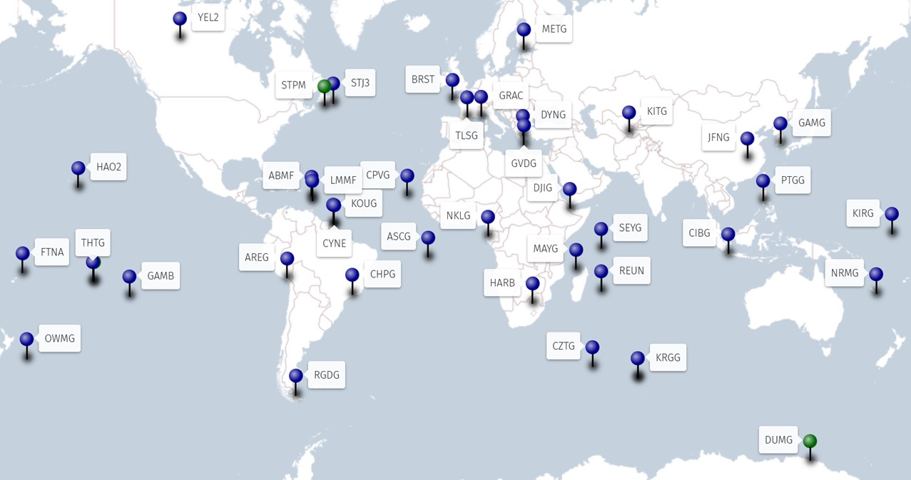
The REGINA infrastructure is based on a global network of more than 30 GNSS stations (see list of stations), equipped with receivers capable of acquiring signals from current and future navigation systems (in particular GPS, GLONASS, GALILEO, BEIDOU and various SBAS) and provide real-time (RT) and non-real time (DT) data streams. Network deployment is done in collaboration with many organizations with the purpose to have the best worldwide coverage. It also includes the upgrade of French GNSS partner stations operated by CNES and the integration of IGN stations. For site selection, it is sought to colocalize several spatial geodesy measurement techniques such as DORIS, in order to participate in international terrestrial reference system (ITRS).
REGINA provide state-of-the-art navigation data to the scientific community with a very good availability. A modern mission center is operational since June 2016 ans allows network monitoring, data processing and data dissemination to users.

Green: standard station, not E6 GALILEO compatible
Blue: newest generation station, E6 GALILEO compatible


